
Understanding the Factors in Drone Photography Pricing
- Zach Metcalf
- Jan 12
- 3 min read

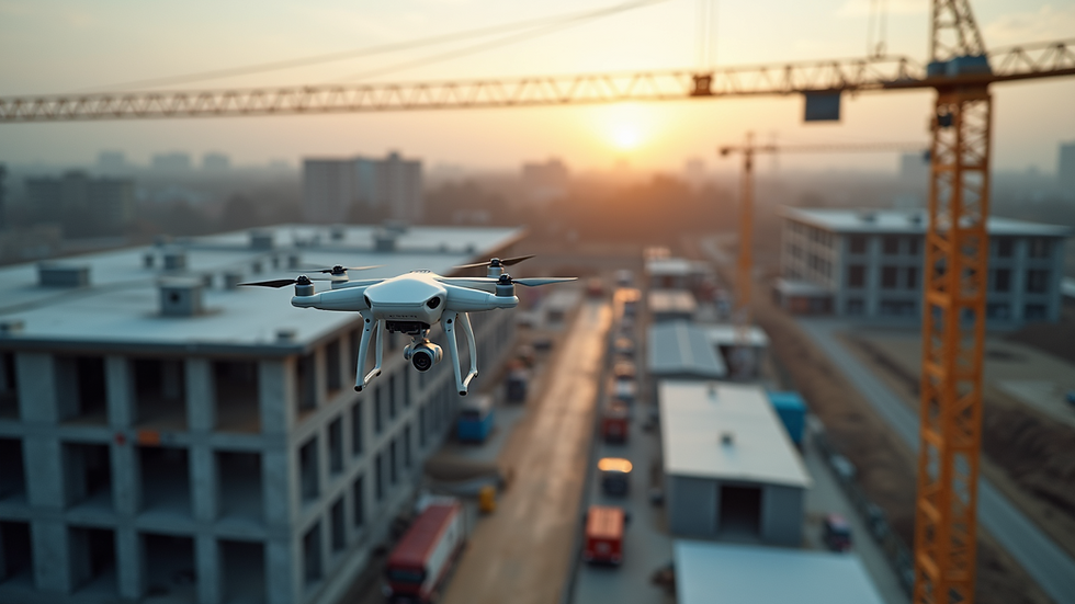
Drone photography has become an essential tool in land development, commercial construction, and construction industries. It offers a unique perspective, providing detailed site documentation and real-time project updates. If you’re considering using drone services or offering them yourself, understanding the costs involved is crucial. I’ll walk you through the key factors that influence pricing and share practical tips to help you make informed decisions.
Key Factors in Drone Photography Pricing
Several elements affect how much drone photography costs. Knowing these will help you budget better or price your services competitively.
1. Equipment Quality and Technology
The type of drone and camera used significantly impacts the price. High-end drones with advanced cameras capture sharper images and more detailed data. For example, drones equipped with thermal imaging or LiDAR sensors cost more to operate but provide valuable insights for construction site monitoring.
2. Flight Time and Complexity
Longer flights or complex maneuvers require more skill and time, increasing costs. Flying over large construction sites or difficult terrain takes more planning and battery swaps. Also, if you need multiple angles or detailed close-ups, expect the price to rise.
3. Location and Accessibility
Where the drone operates matters. Urban areas may require special permits or insurance, adding to the cost. Remote or hard-to-reach sites might need extra travel time or equipment, which also affects pricing.
4. Data Processing and Reporting
Capturing images is just the start. Processing the data into usable reports or 3D models takes time and software. Many clients want detailed project updates highlighting areas of concern, which means additional work beyond just flying the drone.
5. Regulatory Compliance and Insurance
Drone operators must follow FAA regulations and often need insurance coverage. These legal requirements add to operational costs but ensure safety and professionalism.

How much should I charge for drone photography?
Setting your rates depends on your experience, equipment, and the services you offer. Here’s a simple breakdown to help you decide:
Basic Package: Includes a short flight and raw images. Ideal for small sites or quick updates. Prices typically range from $150 to $300 per session.
Standard Package: Offers longer flight time, edited photos, and basic reports. Suitable for medium-sized projects. Expect to charge between $300 and $600.
Premium Package: Includes detailed data processing, 3D mapping, thermal imaging, and comprehensive reports. Best for large or complex sites. Rates can go from $600 to $1,500 or more.
Remember, these are general guidelines. You should adjust based on your market, client needs, and the value you provide.
Practical Tips to Manage Drone Photography Costs
If you want to get the most value from drone photography without overspending, consider these tips:
Plan Your Flights Carefully: Define exactly what you need before the drone takes off. This reduces unnecessary flight time and data processing.
Bundle Services: If you need regular updates, consider a subscription platform. This often lowers the per-session cost and ensures consistent documentation.
Choose the Right Package: Don’t pay for premium services if you only need basic images. Match the package to your project’s requirements.
Work with Experienced Operators: Skilled pilots can complete jobs faster and safer, saving you money in the long run.
Stay Informed About Regulations: Avoid fines or delays by ensuring all permits and insurance are in place before flying.
By following these steps, you can control your expenses while still benefiting from high-quality drone imagery.

Why Investing in Drone Photography Makes Sense for Your Projects
Drone photography is more than just cool aerial shots. It’s a powerful tool for tracking progress, identifying issues early, and improving communication among stakeholders. Here’s why it’s worth the investment:
Improved Site Documentation: You get accurate, up-to-date visuals that help monitor construction phases.
Enhanced Safety: Drones can inspect hazardous or hard-to-reach areas without putting workers at risk.
Better Decision Making: Detailed data allows project managers to address concerns promptly, avoiding costly delays.
Marketing and Reporting: High-quality images and videos can showcase your project’s progress to clients and investors.
Using a subscription platform for drone services can streamline this process, providing regular updates and easy access to data. This ongoing documentation supports transparency and accountability throughout the project lifecycle.
Final Thoughts on Drone Photography Pricing and Value
Understanding the factors that influence drone photography pricing helps you make smarter choices. Whether you’re hiring a service or setting your rates, consider equipment, flight complexity, location, data processing, and legal requirements. Keep your goals clear and choose packages that fit your needs.
If you want to explore more about drone photography cost, check out resources that break down pricing in detail. Remember, investing in quality drone services can save you time, reduce risks, and improve project outcomes.
By integrating drone photography into your land development or construction projects, you gain a competitive edge and ensure your work is documented with precision and professionalism.


Comments