
Creating Stunning Visuals with Drone Photography
- zachmetcal4
- Aug 22, 2025
- 4 min read
In the fast-paced world of land development, commercial construction, and construction industries, staying ahead means having the best tools to document progress and communicate updates clearly. One of the most powerful tools available today is professional drone photography. It offers a unique perspective that traditional photography cannot match, providing detailed aerial views of sites, tracking project milestones, and identifying areas of concern early on.
Using drones to capture high-quality images and videos can transform how you present your projects to clients, stakeholders, and teams. This article explores how professional drone photography can elevate your site documentation, what you need to get started, and practical tips to maximize its benefits.
The Power of Professional Drone Photography in Construction and Land Development
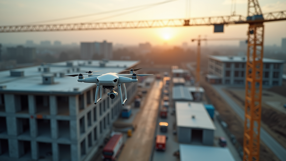
Professional drone photography brings a bird’s-eye view to your projects, allowing you to capture expansive areas quickly and efficiently. This is especially valuable in land development and commercial construction, where large sites can be difficult to monitor from the ground.
Some key advantages include:
Comprehensive Site Documentation: Drones can capture the entire site in a single flight, providing a complete visual record of progress.
Improved Project Management: Regular aerial updates help project managers track milestones and identify potential issues before they become costly problems.
Enhanced Communication: Visual data from drones can be shared with clients and stakeholders, offering transparency and building trust.
Safety and Accessibility: Drones can access hard-to-reach or hazardous areas without putting personnel at risk.
For example, a commercial construction company can use drone imagery to monitor the installation of structural elements, ensuring everything aligns with the project plan. Similarly, land developers can track grading and earthworks progress, comparing current conditions with design plans.

How to Integrate Professional Drone Photography into Your Workflow
Integrating drone photography into your project workflow requires planning and clear objectives. Here are some actionable steps to get started:
Define Your Goals: Determine what you want to achieve with drone imagery. Is it progress tracking, marketing, or identifying site issues?
Schedule Regular Flights: Consistency is key. Schedule drone flights at regular intervals to capture ongoing progress.
Use a Subscription Platform: Platforms that specialize in site documentation and data management can streamline how you access and share drone images and videos.
Train Your Team: Ensure your team understands how to interpret drone data and use it effectively in decision-making.
Leverage Data Analytics: Some platforms offer tools to analyze drone data, such as measuring volumes or detecting changes over time.
By following these steps, you can turn drone photography into a strategic asset that supports project success and client satisfaction.

What is needed for drone photography?
To successfully implement drone photography, you need the right equipment, permissions, and skills. Here’s a breakdown:
Drone Equipment: Invest in drones equipped with high-resolution cameras and GPS capabilities. Models with obstacle avoidance and stable flight controls are preferred for construction sites.
Licensing and Regulations: Ensure compliance with local aviation laws. In the US, this means obtaining a Part 107 Remote Pilot Certificate from the FAA.
Flight Planning Software: Use apps that help plan flight paths, automate image capture, and ensure coverage of the entire site.
Data Management Tools: Choose platforms that allow you to store, organize, and analyze images and videos efficiently.
Skilled Operators: Hire or train drone pilots who understand both the technical and safety aspects of flying drones on construction sites.
Having these elements in place ensures your drone photography efforts are safe, legal, and effective.
Practical Tips for Capturing Stunning Drone Images on Construction Sites
Capturing high-quality drone images requires more than just flying a drone. Here are some practical tips:
Plan for Optimal Lighting: Early morning or late afternoon provides soft, warm light that enhances image quality.
Use Multiple Angles: Capture wide shots for context and close-ups for detail.
Maintain Consistent Altitude: This helps in comparing images over time.
Focus on Areas of Concern: Highlight sections where issues like erosion, equipment placement, or material storage need attention.
Incorporate Project Milestones: Document key phases such as foundation pouring, framing, and finishing.
By applying these tips, you can create compelling visuals that tell the story of your project’s progress and challenges.

Maximizing the Value of Your Drone Photography Subscription Platform
Subscribing to a drone photography platform can provide ongoing benefits beyond just image capture. These platforms often offer:
Automated Reporting: Generate progress reports with annotated images.
Real-Time Updates: Share live feeds or recent images with remote teams.
Issue Tracking: Mark and track areas of concern directly on images.
Historical Data Access: Review past images to analyze trends and changes.
Integration with Project Management Tools: Sync drone data with your existing software for seamless workflow.
Using a subscription platform designed for construction and land development ensures you get the most out of your drone photography investment. It helps you stay organized, communicate effectively, and make informed decisions that drive project success.
Incorporating professional drone photography into your land development or construction projects is a game-changer. It provides unmatched visual insights, improves communication, and supports proactive management. By investing in the right equipment, training, and subscription platforms, you can create stunning visuals that not only document your work but also help increase sales and client satisfaction.
For more information on how to leverage drone photography for your projects, explore specialized services that cater to your industry needs.


Comments